Thaw
Thaw is the melting of snow or ice at the Earth’s surface due to a temperature rise above 0°C (WMO, 1992).
Primary reference(s)
WMO, 1992. International Meteorological Vocabulary. WMO-No. 182. World Meteorological Organization (WMO). Accessed 16 May 2025.
Annotations
Additional scientific description
Additional definitions of thaw include:
To melt a substance, ice for example, by warming it to a temperature greater than the melting point of the substance, or to have frozen contents melted (AMS, 2012).
To free something from the binding action of ice by warming it to a temperature above the melting point of ice (AMS, 2012). A warm spell when ice and snow melt, for example, 'January thaw' (AMS, 2012).
Metrics and numeric limits
Not applicable.
Key relevant UN convention / multilateral treaty
Sendai Framework for Disaster Risk Reduction 2015-2030.
Drivers
A spring thaw is when warmer temperatures and resulting snow melt can produce large amounts of runoff in a short period of time, as each cubic foot of compacted snow contains gallons of water. During early spring, frozen land prevents melting snow or rainfall from seeping into the ground. The water then runs off the surface and flows into lakes, streams, and rivers, causing excess water to spill over their banks. The addition of seasonal storms can result in severe spring flooding (US FEMA, no date).
Impacts
Repetition of freeze/thaw episodes may result in landslides, rockfalls and topples.
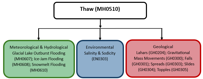
Multi-hazard context
The figure below summarises common interactions between thaw and other hazards. This information should be used with caution and not be solely relied upon in Disaster Risk Management, particularly as some interactions may not have been included. Note that hazardous events occurring together or locally in space or time may not necessarily cause, amplify, or be otherwise related to each other. Specific examples of multi-hazard context can be found in the ‘Hazard drivers’ and ‘Impacts’ sections above.
Multi-hazard diagram
Risk Management
No information Available
Monitoring
The section above and the table below offer an overview of monitoring thaw. This information can be used for forecasting within a national early warning system (EWS). Since EWS capacities and processes differ across countries, the most current and specific information regarding EWS should be obtained from the appropriate national or regional agency/authority responsible for disaster management.
| Which institution(s) produce(s) Disaster Risk Data/Information? |
|
| How is the Hazard Observed/Monitored/Forecast? | Thaws are monitored using satellites, weather stations, and ground sensors to track rising temperatures, snowmelt, and soil moisture changes. Meteorologists analyse temperature trends using weather models to predict thawing events. Hydrologists use models to assess snow and ice melt rates, helping forecasters issue early warnings if required. These warnings assist farmers, infrastructure managers, and emergency responders in preparing for potential flooding, landslides, and road damage caused by rapid thawing. |
References
AMS, 2012. Glossary of Meteorology: Thaw. American Meteorological Society (AMS). Accessed 16 May 2025.
US FEMA, no date. Spring Flooding: Risks and Protection. US Federal Emergency Management Agency (FEMA). Accessed 16 May 2025.
WHO, no date. Flooding and communicable diseases fact sheet. World Health Organization (WHO). Accessed 16 May 2025.
WHO, 2013. Floods in the WHO European Region: Health effects and their prevention. Regional Office for Europe, World Health Organization (WHO). Accessed 16 May 2025.