Hazards and Drivers of Urban Risk
Claudia Soto Orozco, World Bank’s Urban, Resilience and Land department for West Africa
Claudia Soto Orozco is a Disaster Risk Management Specialist in the World Bank’s Urban, Resilience and Land department for West Africa. Her work spans the areas of urban resilience, disaster risk management and local development in Niger where she is a task team leader for investment programs. She holds a bachelor’s degree in Economics from American University and a Master’s degree in International Economics from the Graduate Institute of International and Development Studies, Geneva. Prior to joining the Bank, she worked in the insurance and risk management field in the private sector.
1. What are some of the main drivers of urban risk?
Disasters cost cities more than $300 billion every year. This is greater than the GDP of South Africa, and puts everything in cities at risk, from the health and lives of urban residents to their homes and livelihoods.
This reality shows that a combination of factors can drive urban risk, including:
- Rapid urban population growth and infrastructure exposure to natural hazards, such as floods, hurricanes, and earthquakes. Today, 4.4 billion people—equivalent to 56 percent of the global population—live in cities.
- High physical vulnerability of infrastructure that cannot withstand the impacts of natural hazards. Statistics show that 70 percent of cities have already witnessed adverse impacts on their citizens and infrastructure as a result of climate change.
- Limited emergency preparedness and response capacity and tools available at the municipal level, such as contingency plans and early warning systems.
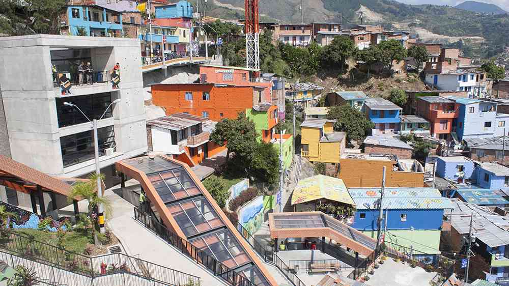
Medellin, Colombia
What particular challenges do cities face in preparing for disasters?
An important challenge that cities face, for example for flood risk, is the lack of urban management capacity at the municipal level. Municipalities often struggle to find sufficient human and financial resources to address the drivers of urban risk effectively. This lack of urban management capacity is reflected by limited spatial planning and building regulations enforcement, inadequate waste management practices, the emergence of informal settlements in risky areas, and environmental degradation in the watersheds upstream of urban areas.
What role does urban planning play in disaster risk reduction and urban resilience?
Risk-informed urban planning is the most effective disaster risk management strategy, particularly when involving stakeholders. This approach seeks to avoid developing new disaster risks by steering urban growth and development away from risky areas rather than aiming to correct or reduce the risk already present in existing infrastructure and urban settlements. Corrective approaches are more costly and socially complex, as planning takes place both in formal and informal contexts involving a multitude of stakeholders.
Can you think of any effective strategies/approaches urban planners can take to better integrate disaster risk reduction in planning?
To better manage disaster risk, urban planners need to understand the disaster risk faced by the city, including exposure to natural hazards and also the level of physical and social vulnerability, and population movements, in particular in fragility, conflict, and violence (FCV) affected countries. The World Bank’s City Resilience Program (CRP), for example, is helping to fill this information gap through City Scan, a rapid assessment of a city’s key urban characteristics and resilience challenges.
A multi-hazard approach is also needed to ensure that all risks are addressed comprehensively, along with making high-quality risk information and assessments available to planners as a basis for urban and land use planning. In Chișinău, Moldova, for example, CRP built additional maps and information on the city’s seismic risk and in Khartoum, Sudan, the Program created an extensive set of maps on flood hazard. Through all these strategies and approaches, participatory processes in risk-informed land use planning practices strengthens the resilience of urban communities.

Chișinău, Moldova
Generally speaking, do you feel that disaster risk reduction is effectively addressed in urban planning? Why or why not?
Urbanization is key to growth and development, but for cities to be sustainable, healthy, safe, and vibrant, municipalities know that building resilience to climate change and disaster risks is a must. Land use and spatial planning must incorporate disaster risk reduction measures to promote climate resilience, and should be integrated into country development frameworks to ensure these are applied at local level, targeting vulnerable and minority groups. Cities are making progress in strengthening disaster risk management and ensuring that infrastructure systems are designed and constructed for current and future climate risks, but more needs to be done.
All too often, urban planning lacks disaster risk information. When data are available, the information is frequently not incorporated into planning by municipal governments, as many governments do not have the capacity to mainstream risk into planning. This includes the development of regulatory and technical capacities through relevant guidelines and/or comprehensive training programs, including in the areas of risk-informed spatial planning and zoning; building regulations and practices; resilient infrastructure planning and execution; integration of nature-based solutions (NBS) in flood risk-reduction investments; and early warning systems for emergency preparedness and response.
Urban planning tools also should be accompanied by development plans to ensure that investments are effectively budgeted for, executed, and maintained. These plans should also be informed by active community engagement from the people the plan is meant to protect. Integrating disaster risk information remains challenging, especially in low- and lower-middle-income countries, where local capacities in urban planning, investment planning and execution, and operation and maintenance are limited.
Still, some cities are making concrete strides to increase resilience to disaster and climate change risk. The World Bank is supporting the municipality of Thủ Đức in Vietnam ensure that their new masterplan is risk informed. Grounded in an understanding of disaster risk, a flood risk management protection program, integrating physical and natural solutions, is under development. The plan seeks to avoid the creation of new risk, create attractive public spaces to absorb flood waters and invest in additional physical protection measures. The capital investment plan used to materialize the masterplan is informed by a spatial computable general equilibrium model to identify and prioritize those investments with the highest long- term rate of return, incorporating climate risk. Finally, to empower the city to more proactively guide the spatial development of the city, a series of policy notes informed the ongoing land law revision, including a case study on Thủ Đức illustrating the practical consequences of reforms to land use planning and value capture. This analysis builds on a recent survey of Wroclaw, Poland, where increases in land values and property tax revenues offset the investment costs of a large-scale flood risk management system.
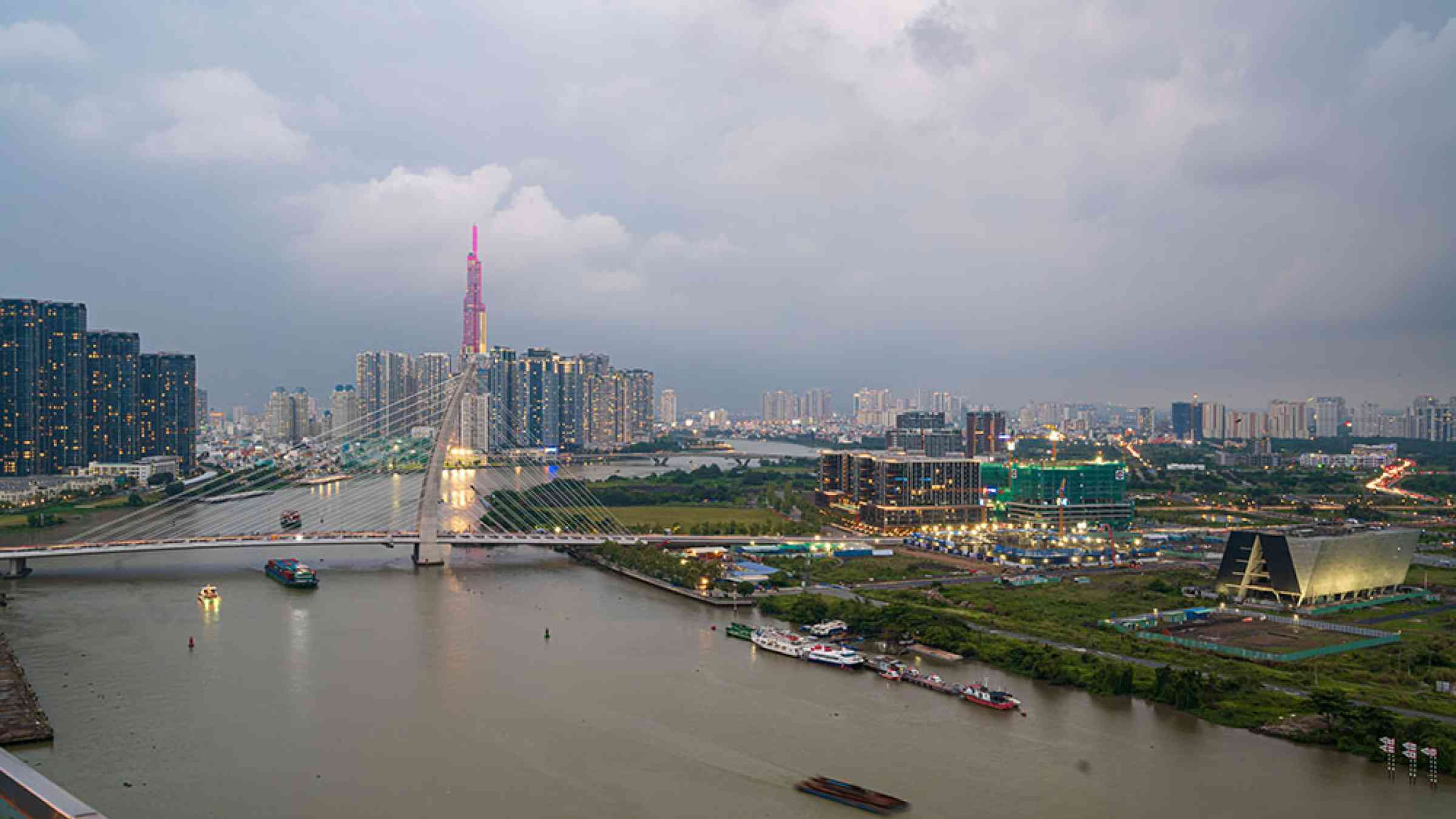
View of Thủ Đức, Vietnam
Can you think of a few examples of successful urban planning initiatives? What kinds of spatial/ land use/ or urban plans were deployed?
Urban growth in the five countries of Burkina Faso, Chad, Mali, Mauritania, and Niger in the Sahel region of Africa has been rapid, mostly uncontrolled, and fragmented. As a result, most towns and cities struggle to provide infrastructure and basic services, and lack the financial resources to keep up with the rapid increases in population. There is an opportunity to prevent risky urban growth and create climate-resilient cities, through sustainable urban development with infrastructure and services that strengthen climate resilience, reduce the cost of disasters, and enhance integration with nature. For example in Niger, the Niger Integrated Urban Development and Multi-sectoral Resilience Project addresses the effects of high flood risk and rapid urban growth through an integrated approach. This project supports resilient urban development and disaster risk management in 25 municipalities, benefitting 3.4 million people. It aims to (i) improve access to urban infrastructure and basic services, including the building of embankments, flood barriers, and drainage systems; and (ii) build the capacity of municipalities to improve day-to-day urban management and ensure that climate risk considerations inform land use, spatial, and investment plans at the municipal level.
Are you aware of any examples where disadvantaged communities have taken steps towards DRR in their local environment?
Municipalities in Haiti have teamed up with communities and created Municipal Civil Protection Committees (Comités Communaux de Protection Civile – CCPC) to ensure effective preparedness and response to hydrometeorological hazards. This network of well-organized volunteer organizations has been instrumental in evacuating the population and saving lives after major natural hazards. They also support municipal authorities in identifying risky areas and informing municipal development plans.
How can initiatives like these be supported or scaled up?
Municipalities need to adopt a proactive, participatory approach to inform the development of urban plans and investments systematically. This can be achieved through (i) comprehensive community and stakeholder consultations at the start and throughout the planning, budgeting, and execution process and (ii) the creation of community groups to provide support in the supervision of infrastructure investments and operation and maintenance activities. Vulnerable groups, such as women, youth, and people with disability, should be involved to ensure they also benefit from this process. From an investment perspective, achieving scale also tends to require some form of standardization and/or coordination between municipalities with similar needs, and with national government. This approach helps reduce transaction costs and the time required to get projects to implementation.
An example of this programmatic approach is underway in South Africa, where a cohort of seven municipalities joined a two-year capacity building and project preparation program. Supported by CRP, the program advanced preparation of nine urban resilience investments while also helping the municipalities develop a better understanding of urban heat as an emerging risk.
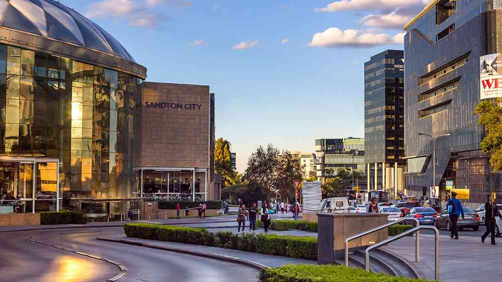
Sandton is a financial centre of Johannesburg, South Africa and forms part of the City of Johannesburg Metropolitan Municipality.